🗓️ Last updated: by Sunil Verma (Founder & Director), Travel Himalayas, Manali – HP Govt. approved tour operator since 2002
About Lahaul & Spiti
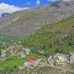
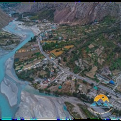
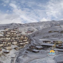
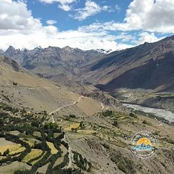
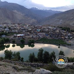
Lahaul and Spiti is the largest district of Himachal – a cold desert at 3,000 – 4,500 m between the Himalaya and Tibet. Lahaul (Sissu, Keylong, Jispa) is reached through the Atal Tunnel; Spiti (Kaza, Tabo, Key, Chandratal) via Kunzum La (4,551 m) from Manali or via Kinnaur from Shimla.
Thousand-year-old monasteries, fossil villages, the world’s highest post office and the moon lake of Chandratal make it one of India’s great road trips.
Lahaul & Spiti – Quick Facts
State
Himachal Pradesh
Altitude
Kaza 3,800 m; Kunzum La 4,590 m
Nearest airport
Bhuntar – 250 km from Kaza
Routes
Manali – Kunzum La (4,551 m) – Kaza (June – Oct); Shimla – Kinnaur – Kaza (all year)
Best time
June – October; winter expedition December – March
Ideal stay
6 – 9 days
Places to Visit in Kinnaur, Lahaul & Spiti
Tap any place to see its full road route, distance in km and map.
🏔️ Lahaul
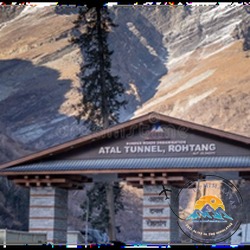
Atal Tunnel · 3,000 m 9 km highway tunnel under the Rohtang range, opened in 2020 – Manali to Lahaul in about 1 hour, open most of the year.
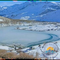
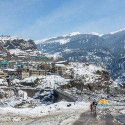
Sissu · 3,130 m Village just north of the tunnel on the Chandra river with a tall waterfall, a small lake and snow play in winter and spring.
Khoksar · 3,140 m First Lahaul village on the old Rohtang road, on the Chandra river – police check post and dhabas.
Gondhla · 3,160 m Village with the 17th-century Gondhla Fort, a tall wooden tower house, and views of the Gyephang peak.
Keylong · 3,080 m Headquarters of Lahaul on the Bhaga river – base for Kardang, Shashur and Tayul monasteries.
Jispa · 3,200 m Riverside camping village on the Bhaga – a popular night halt on the Manali – Leh highway.
Darcha · 3,360 m Check post and junction where the Shinku La road leaves for Zanskar.
Deepak Tal · 3,800 m Small roadside lake near Patseo on the Manali – Leh highway.
Suraj Tal · 4,890 m Holy high lake, source of the Bhaga river, just below Baralacha La.
Baralacha La · 4,890 m High pass on the Manali – Leh highway where the Lahaul, Spiti and Ladakh regions meet.
Trilokinath Temple · 2,760 m Ancient shrine in the Pattan valley worshipped by both Hindus (as Shiva) and Buddhists (as Avalokiteshvara).
Udaipur (Mrikula Devi) · 2,650 m Pattan valley village with the finely wood-carved Mrikula Devi temple.
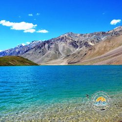
Chandratal Lake · 4,300 m Crescent moon lake reached from Batal – camps open approx. June – September.
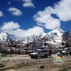
Batal & Kunzum Pass · 4,551 m Kunzum Pass with the Kunzum Devi temple is the gateway from Lahaul into Spiti; Batal is the dhaba stop below it.
☸️ Spiti
Losar · 4,080 m First village of Spiti after Kunzum Pass, with a check post and homestays.
Kaza · 3,650 m Main town of Spiti – petrol, ATM, market, hotels and homestays; base for all day trips.
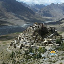
Key Monastery · 4,166 m Hilltop gompa of the 11th century above the Spiti river.
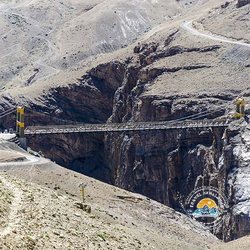
Kibber & Chicham Bridge · 4,270 m High village and Asia’s highest suspension bridge.
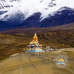
Langza · 4,400 m Fossil village with a big Buddha statue.
Hikkim · 4,400 m World’s highest post office (4,400 m).
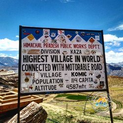
Komic · 4,500 m One of the highest motorable villages with a monastery.
Dhankar · 3,890 m Cliff monastery and a high lake.
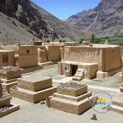
Tabo Monastery · 3,280 m Founded in 996 AD – the Ajanta of the Himalaya.
Pin Valley Snow leopard country and Mud village.
Lhalung · 3,660 m Quiet village with the old Lhalung (Serkhang) monastery in the Lingti valley.
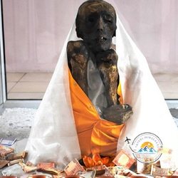
Gue Mummy Gue village near Sumdo has a naturally preserved mummy of a Buddhist monk, believed to be about 500 years old.
🍎 Kinnaur
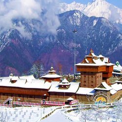
Sarahan (Bhimakali Temple) · 2,165 m Gateway to Kinnaur with the famous wooden Bhimakali temple and views of the Srikhand range.
Sangla Valley · 2,680 m Green valley of the Baspa river with apple orchards and the Kamru fort.
Rakchham · 3,050 m Riverside village on the Baspa between Sangla and Chitkul.
Chitkul · 3,450 m Last village on the road near the Indo-Tibet border, on the Baspa river.
Reckong Peo · 2,290 m Headquarters of Kinnaur district – market, bank and petrol.
Kalpa · 2,960 m Village facing the Kinnaur Kailash range, with apple orchards and the Suicide Point viewpoint.
Khab Sangam Confluence of the Spiti and Sutlej rivers on the Hindustan – Tibet road.
Nako · 3,660 m Village with a small lake and an old monastery near the Spiti border.
Cities & Places
Tap a city to see all its sightseeing places with photos, distance and entrance fee.
Lahaul & Spiti Road Map – Distances from Town
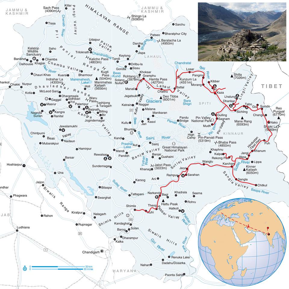
The Himachal road map from our Manali taxi rates page. Each colour = one road route; Spiti to its sightseeing places (gold rings); white tags = km between places (approx.; dashed = trek, ferry or flight).
🖱️ Click the map, then scroll to zoom · drag to move · on mobile pinch with two fingers · 🔍 = zoom to these places · ⟲ = whole map
Best Time to Visit Lahaul & Spiti
June – mid October: both routes open – best season
May: Kinnaur route open, Kunzum La closed
December – March: Winter Spiti expedition via Kinnaur – −20 °C
Via Manali: Manali – Atal Tunnel – Gramphu – Batal – Kunzum La – Kaza (8 hrs, June – Oct).
Lahaul & Spiti Distance Chart
Route
Distance
Drive time
Manali – Kaza
200 km
8 hrs
Shimla – Kaza
420 km
2 days
Kaza – Chandratal
85 km
4 hrs
Kaza – Tabo
47 km
1.5 hrs
Kaza – Key
14 km
30 min
Manali – Keylong
115 km
3.5 hrs
Hikkim (Highest Post Office in the World)
15 km
45 mins
Key Monastery
15 km
30 mins
Langza (Giant Maitreya Buddha Statue)
15 km
45 mins
Kibber (Asia’s Highest Village)
20 km
1 hr
Komic (Highest Village in the World)
20 km
1 hr
Dhankar Monastery
25 km
1–2 hrs
Tabo
45 km
1–2 hrs
Pin Valley
50 km
1–2 hrs
Losar
55 km
2–3 hrs
Kunzum Pass (4,551 m)
75 km
3–4 hrs
Gue Monastery
90 km
3–4 hrs
Chandratal Lake
105 km
4–5 hrs
Nako Lake
110 km
4–5 hrs
Rohtang Pass (3,978 m)
160 km
6–7 hrs
Sissu
160 km
6–7 hrs
Atal Tunnel
175 km
7–8 hrs
Solang Valley
185 km
7–8 hrs
Keylong
190 km
7–8 hrs
Jispa
210 km
8–9 hrs
Darcha
215 km
8–9 hrs
Kalpa
215 km
8–9 hrs
Kullu
240 km
8–9 hrs
Bhuntar
250 km
9–10 hrs
Sangla
250 km
9–10 hrs
Chitkul (India’s Last Village)
270 km
10–11 hrs
Kasol
280 km
10–11 hrs
Manikaran
285 km
10–11 hrs
Jibhi
295 km
10–11 hrs
Sarahan
305 km
11–12 hrs
Mandi
310 km
11–12 hrs
Rampur Bushahr
310 km
11–12 hrs
Bilaspur
375 km
12–13 hrs
Approximate road distances and times – mountain roads can take longer in snow or rain.
Lahaul & Spiti Map
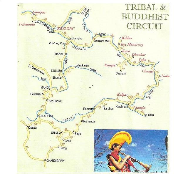
Map of Lahaul & Spiti – Kaza, Key, Kibber, Chandratal & Kunzum La (tap to enlarge)Spiti circuit map – Shimla, Kinnaur, Kaza & Manali (tap to enlarge)
Lahaul & Spiti Travel Tips
Go up via Kinnaur and come down via Manali for better acclimatisation.
Carry cash and a postpaid SIM.
Fuel up at Kaza.
Entrance & Permit Fees in Lahaul & Spiti 2026
Permits
Indians: no permit needed for Spiti or Lahaul.
Foreigners: Inner Line Permit for the Jangi – Sumdo stretch (Kinnaur – Spiti border) from the SDM at Rekong Peo, Kaza or Shimla – we help you.
🎟️ Entrance fees (per person, paid at the gate or online)
Place
🇮🇳 Indian
🌍 Foreigner
Key Monasterydonation welcome
Free
Free
Tabo Monastery
approx. ₹25
approx. ₹300
Dhankar Monasterydonation welcome
Free
Free
Komic
Free
Free
Hikkim Post Office
Free
Free
Langza
Free
Free
Chicham Bridge
Free
Free
Chandratal Lakeapprox. 1 km walk from the parking
Free
Free
Pin Valley National Park
Free
Free
Nako Lake
Free
Free
Gue Monasterydonation welcome
Free
Free
Fees as published for 2026 and can be revised by the authorities; "approx." rates are local / private and may differ. Children are usually free or half rate. Camera fees extra at some places.
Lahaul & Spiti Tour Packages 2026
Packages by Travel Himalayas that stay in Lahaul & Spiti – hotels and a private cab, with the complete price for your date on each page.
Day 1 Manali → Atal Tunnel → Batal → Chandratal (115 Kms / 6-7 Hours)
Day 2 Chandratal → Kunzum La → Losar → Kaza (100 Kms / 5-6 Hours)
Day 3 Key, Kibber (Asia’s Highest Village), Chicham Bridge (Asia’s Highest Hanging Bridge), Langza (Giant Maitreya Buddha Statue), Komic (Highest Village in the World) & Hikkim (Highest Post Office in the World) (95 Kms / 8-9 Hours)
Day 2 Narkanda → Hatu Peak → Sangla → Rakchham → Chitkul (India’s Last Village) (215 Kms / 9-10 Hours)
Day 3 Chitkul (India’s Last Village) → Sangla → Khab → Nako Lake → Gue → Tabo (235 Kms / 10-11 Hours)
Day 4 Tabo → Dhankar → Kaza → Langza (Giant Maitreya Buddha Statue), Komic (Highest Village in the World) & Hikkim (Highest Post Office in the World) (115 Kms / 7-8 Hours)
Day 2 Narkanda → Hatu Peak → Sangla → Rakchham → Chitkul (India’s Last Village) (215 Kms / 9-10 Hours)
Day 3 Chitkul (India’s Last Village) → Sangla → Kalpa (85 Kms / 4-5 Hours)
Day 4 Kalpa → Khab → Nako Lake → Gue → Tabo (180 Kms / 8-9 Hours)
Day 5 Tabo → Dhankar → Kaza → Langza (Giant Maitreya Buddha Statue), Komic (Highest Village in the World) & Hikkim (Highest Post Office in the World) (115 Kms / 7-8 Hours)
Day 2 Narkanda → Hatu Peak → Sangla → Rakchham → Chitkul (India’s Last Village) (215 Kms / 9-10 Hours)
Day 3 Chitkul (India’s Last Village) → Sangla → Kalpa (85 Kms / 4-5 Hours)
Day 4 Kalpa → Khab → Nako Lake → Gue → Tabo (180 Kms / 8-9 Hours)
Day 5 Tabo → Dhankar → Kaza → Langza (Giant Maitreya Buddha Statue), Komic (Highest Village in the World) & Hikkim (Highest Post Office in the World) (115 Kms / 7-8 Hours)
Day 6 Key, Kibber (Asia’s Highest Village), Chicham Bridge (Asia’s Highest Hanging Bridge), Langza (Giant Maitreya Buddha Statue), Komic (Highest Village in the World) & Hikkim (Highest Post Office in the World) (95 Kms / 8-9 Hours)
Day 7 Kaza → Losar → Kunzum La → Chandratal (100 Kms / 5-6 Hours)
Day 8 Chandratal → Batal → Atal Tunnel → Manali (115 Kms / 6-7 Hours)
Day 4 Tabo → Dhankar → Pin Valley → Frozen Lingti Fall → Kaza (100 Kms / 6-7 Hours)
Day 5 Kaza Snow Circuit – Langza (Giant Maitreya Buddha Statue), Komic (Highest Village in the World), Hikkim (Highest Post Office in the World), Key & Chicham Bridge (Asia’s Highest Hanging Bridge) (100 Kms / 7-8 Hours)
Day 6 Kaza → Snow Run towards Losar → Sangla (240 Kms / 10-11 Hours)
Day 7 Sangla → Chitkul (India’s Last Village) → Shimla (265 Kms / 10-11 Hours)
Day 6 Langza (Giant Maitreya Buddha Statue), Komic (Highest Village in the World) & Hikkim (Highest Post Office in the World) in Snow (45 Kms / 5-6 Hours)
Pay Now opens our secure payment page (UPI, cards, net banking) – pay the advance we confirm on WhatsApp / phone.
Frequently Asked Questions
Is a permit needed for Spiti?
Indians do not need a permit; foreigners need one between Rekong Peo and Sumdo.
What is the best time to visit Lahaul & Spiti?
June – mid October: both routes open – best season. May: Kinnaur route open, Kunzum La closed. December – March: Winter Spiti expedition via Kinnaur – −20 °C.
How to reach Lahaul & Spiti?
Via Kinnaur – Chandigarh – Shimla – Narkanda – Rampur – Reckong Peo – Nako – Tabo – Kaza (2 days). Via Manali – Manali – Atal Tunnel – Gramphu – Batal – Kunzum La – Kaza (8 hrs, June – Oct).
How much does a Lahaul & Spiti tour cost?
Our Lahaul & Spiti packages start from about ₹22,000 per person (2 sharing) with hotels and a private cab – open a package for the complete price on your date.